| Photo Documentation
|
|
|
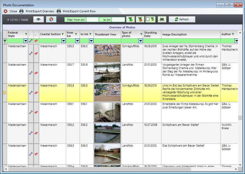
Photos are assigned to the individual response sections. The user
can call them up as an additional source of information to the
common alphanumeric data. Aerial photos that completely display the
coast, as well as detailed photos of areas of interest taken from
the ground, are saved.
The photo documentation is an integral part of the VPS.system
software and is also organised by the database.
|
|
All photos of the photo documentation are linked with the Coastal
and Response Sections.
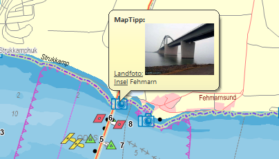
The photos taken from the ground have coordinates added so that a 'one
click link' from photo documentation into the GIS is possible.
In the GIS the photos are shown by the MapTipps amongst others: |
 |
|
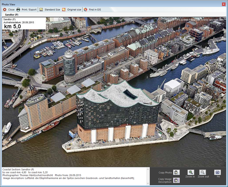
The about 13,300(!) aerial photos, taken of the German North and Baltic Sea
coasts, are an all-embracing information source which enables the
trained user to make statements about the coastal structure, to
locate access possibilities from land and sea, sensitivities
associated with coastal sections and implications for possible
response strategies: |
|
The aerial photos are overlapping and therefore the individual
pictures can be displayed like a video of the coast section to give
the user a quick overview about the structure of the affected
coastal section.
Because the actual coast kilometerage is displayed in the video, a
concurrent use of the database, GIS, photo documentation and video
is possible and useful, to obtain a maximum amount of information
from VPS.System.
The following sample animation shows a complete roundtrip around Helgoland island. |
|
|
| |