|
Sensitivity Mapping North Sea: Evaluation Model
|
|
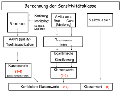
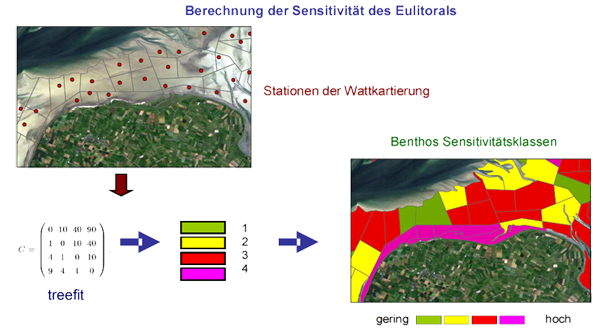
The sensitivity of each location was calculated
using an automated expert system developed at GKSS and based on
neural network techniques and advanced classification methods (treefit).
The design of this model will enable the Central Command for
Maritime Emergencies, as the main-user and sponsor of the present
project, to calculate the spatio-temporal sensitivity of intertidal
areas without extensive further expert assistance.
The complete data sets were used together with a Geographic
Information System (GIS) to generate sensitivity maps of the German
North Sea coast. |
|
|
|