|
Sensitivity Mapping North Sea: Concepts
|
|
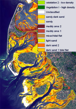
For the first step, individual soft bottom habitats,
communities and stocks of saltmarshes, macrofauna, waterfowl and
estuarine habitat types were evaluated and classified according to
their vulnerability to oil pollution.
The sensitivity of each location was calculated using an automated
expert system developed at GKSS and based on neural network
techniques and advanced classification methods (treefit). The design
of this model will enable the Central Command for Maritime
Emergencies, as the main user and sponsor of the present project, to
calculate the spatio-temporal sensitivity of intertidal areas
without extensive further expert assistance.
|
|
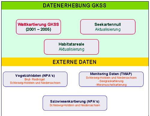
Through their continuous and intensive cooperation with the
users and additional institutions, the staff of the Institute
for Coastal Research succeeded in developing an operational
monitoring system as an important basis for coastal management
and which could be extended for the whole German Bight.
|
|
|
|
|