| Sensitivity Mapping North Sea: Data Retrieval
|
|
The sensitivity of a particular area to oil contamination
depends largely upon the physical characteristics of the habitat,
the susceptibilities of individual species (at various life
stages) and their ecological properties within the communities.
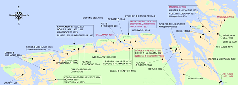
Hence, the fieldwork conducted for habitat mapping during
2003–2006 was a central part of the study. For this work, the
experiences and results obtained from the previous GKSS-project
“Thematic mapping and sensitivity study of Intertidal flats”
during the years 1987–1992 served as an valuable basis. For
example, the documentation of changes between these periods of
observation provides information on stability features of the
ecosystems. During the first project, nearly 5,000 locations
were processed and characterised using about 70 parameters for
each site.
|
|
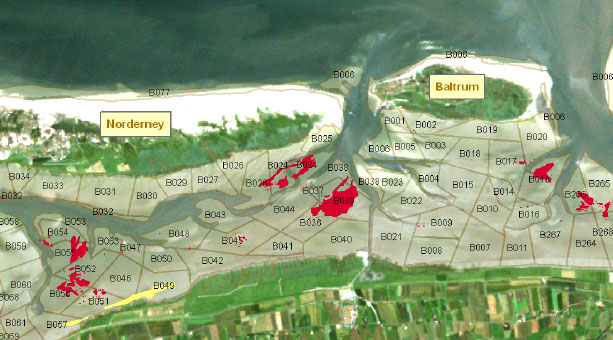
The in-situ mapping was a combination of estimated and measured values,
collected along a grid network of locations with 1-km intervals. The estimated
values, including biotic and abiotic parameters, were documented using a
standardised protocol (“record sheet”). They comprised, for example, information
on the presence of micro- and macroalgae, surface structure (i.e., ripple,
colour) and sediment characteristics. The measured values included grain size,
shear strength, water content of sediments, as well as the macrofauna species
present.
|
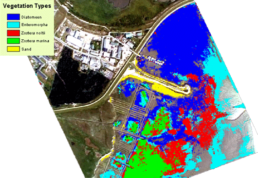
The spatial distribution of the sensitivity of tidal flat areas
was combined with data on salt marsh distribution and the presence of seagrass
and mussel beds. These additional data were integrated using the monitoring
results of the national park authorities of Lower Saxony, Schleswig-Holstein and
Hamburg.
|
|
 |
|
The temporal aspects of this sensitivity was also calculated using the
monitoring data of breeding and migratory birds which are compiled yearly by
these authorities.
|
|
|
|
| |